Validation of sea ice edge, concentration - Full domain
Bulletin date: 2017-02-09
Model: ARC MFC - TOPAZ
Data source: OSI SAF N.H. sea ice concentration
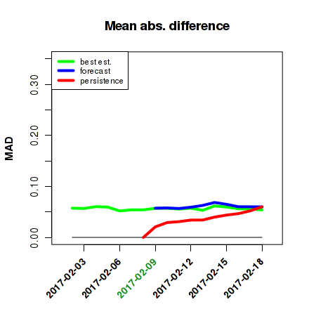
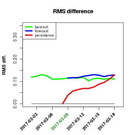
Sea ice concentration
Mean absolute difference
|
RMS difference
|
|
|
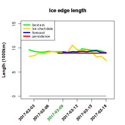
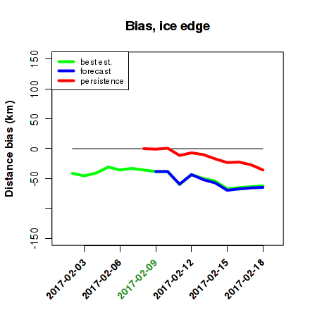
Sea ice edge length, position
Sea ice edge length
|
Sea ice edge position bias
|
|
|
Mean absolute difference
|
RMS difference
|
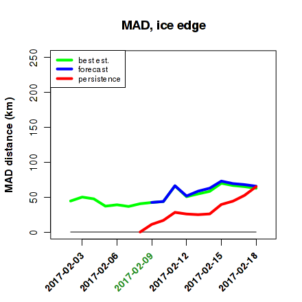
|
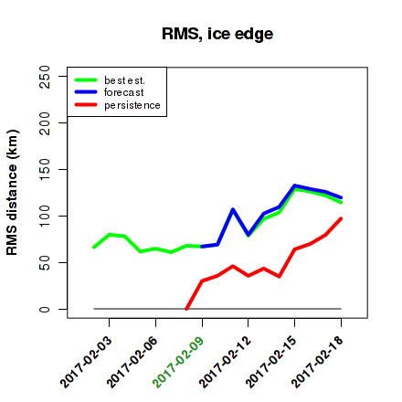
|
Integrated ice edge error (IIEE)
Area metric (original)
|
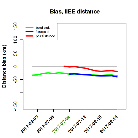
Distance (length) derivative
|
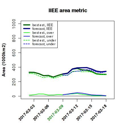
|
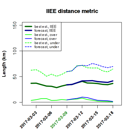
|
Distance bias
| |
| |
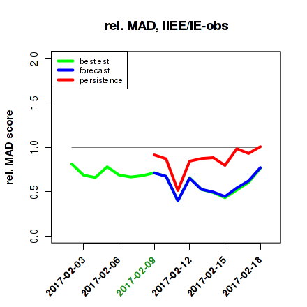
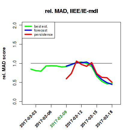
Relative distance metrics [IIEE/IE]
Score w/ obs. reference
|
Score w/ model reference
|
|
|
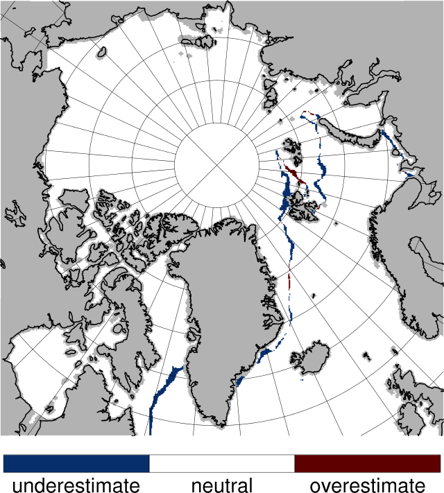
Sea ice concentration IIEE areas, 2017-02-08
Best estimate vs. observations
|
|
IIEE over- and underestimated regions are shaded
|
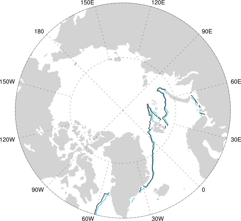
Sea ice edge position map, 2017-02-08
|
|
Edge nodes from observations in blue, from model best estimate in black
|
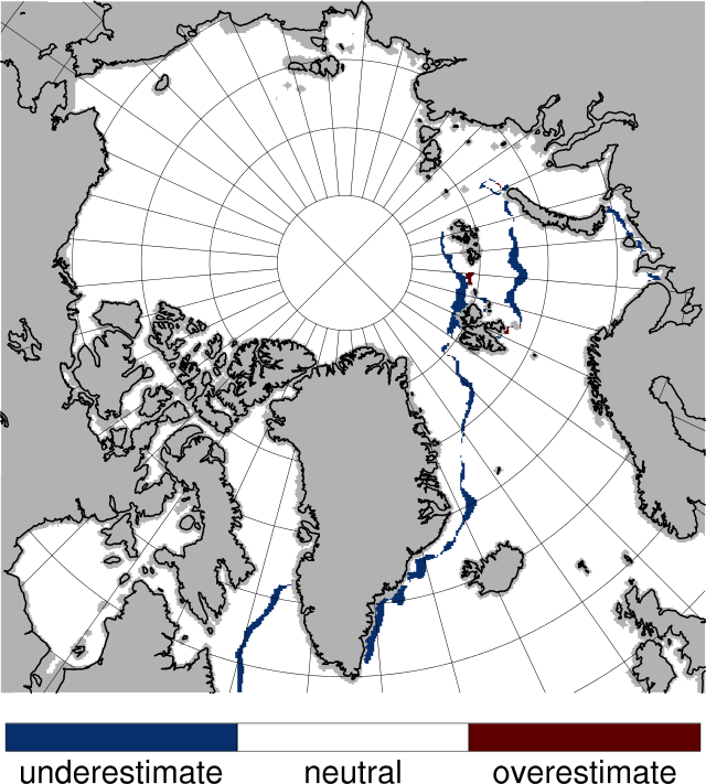
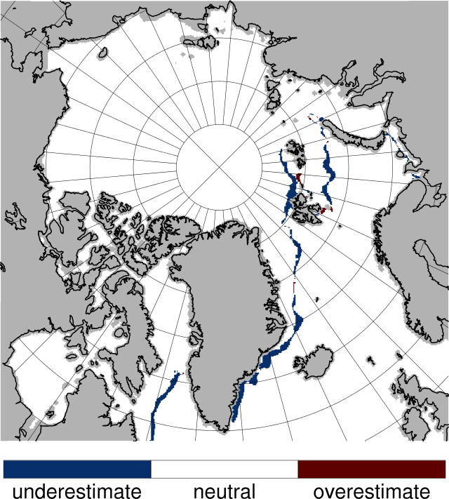
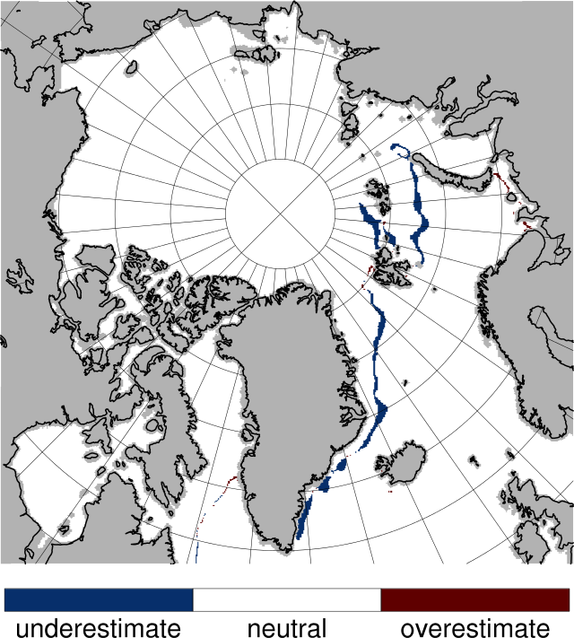
Sea ice concentration IIEE areas, 2017-02-15
Best estimate vs. observations
|
|
IIEE over- and underestimated regions are shaded
|
Forecast vs. observations
|
|
IIEE over- and underestimated regions are shaded
|
Persistence vs. observations
|
|
IIEE over- and underestimated regions are shaded
|
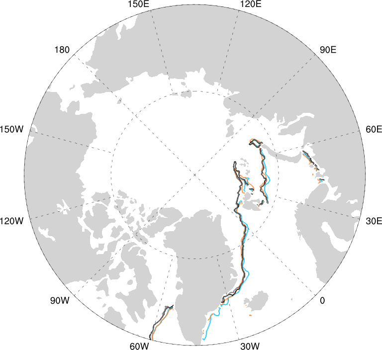
Sea ice edge position map, 2017-02-15
|
|
Edge nodes from observations in blue, from persistence in brown, from model best estimate in black, from model forecast in grey
|
Generated by /metno/routine/sms/V2/xSIvalidation/xSIwebPage.sh to. 31. mai 01:59:34 +0000 2018 on arcmfcval


