Copernicus Marine Service Arctic MFC: Validation of sea surface temperature
Validation results: Drifting buoy data
Bias is defined as spatial averages of model values - observed values.
Validation Data: Drifting buoy data
Validation of the Copernicus Marine Arctic MFC results for sea surface temperature is performed using data from drifting buoys, which are compiled by the Copernicus Marine SST TAC. New sets of buoy data are available weekly. The buoy data are available with a temporal resolution of 3 hours. These data are converted to daily mean values to conform with the TOPAZ model results. Note that the analysis is not restricted to night-time data.
Buoy data are available from CERSAT-IFREMER in collaboration with Coriolis (from ftp.ifremer.fr/ifremer/cersat/projects/myocean/sst-tac/insitu/data/). The drifters have been deployed under the Surface Velocity Program. Additional information about the data is available from The Global Drifter Program at NOAA.
Validation results: Satellite data
Computation of anomaly correlations include use of daily climatology derived from results of the ARCMFC reanalysis product, for the 20 year period 2002-07-01 - 2022-06-30. Positive values corresponds to a model forecast being better aligned with observational data than the daily climatology and the observations.
Validation Data: Satellite data
Validation of the Copernicus Marine Arctic MFC results for sea surface temperature is performed using AVHRR data from the Metop-B satellite.
AVHRR Metop-B satellite data are available from IFREMER-Coriolis who operates the Copernicus Marine SST TAC.
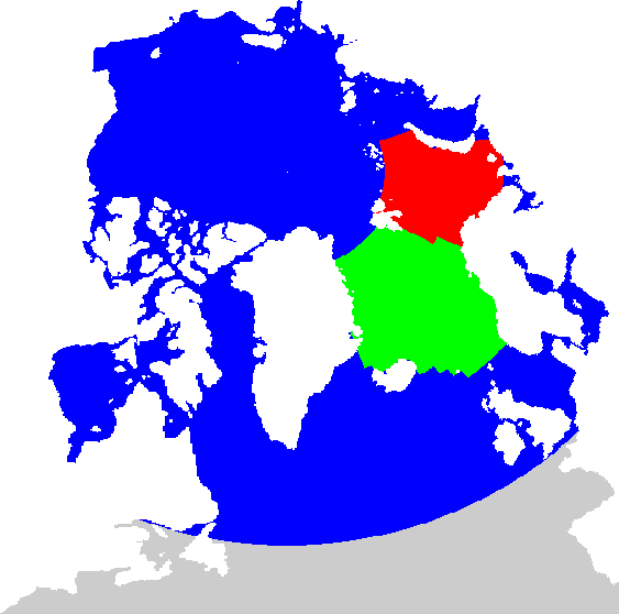
Regions
The ocean circulation model used in Copernicus Marine Arctic MFC covers the Arctic Ocean, the North Atlantic Ocean and adjacent ocean regions. The northern part is depicted in the figure below. Validation of sea surface temperature from model results is performed for three domains:
- an extended domain indicated by the blue, green and red regions in the figure
- the Nordic Seas, shown as the green region
- the Barents Sea, depicted in red
ARCMFC PHYS (TOPAZ)
The model results are produced with the TOPAZ ocean data assimilation model system. Presently, TOPAZ is run weekly with data assimillation one week prior to the bulletin date, then applying a one-week 100 member ensemble simulation ending on the bulletin date. Then, for each day a 10 day deterministic forecast is produced. TOPAZ was developed and is maintained by the Nansen Center.
ARCMFC PHYS (TOPAZ) results are available as Copernicus Marine product ARCTIC_ANALYSISFORECAST_PHY_002_001 from the Copernicus Marine Data Store. An archive of historical forecasts are available from a thredds server.
